- Highlights areas that are affected or vulnerable to a particular hazard.
- Needed for identification of natural hazards such as earthquakes, volcanoes, landslides, flooding and tsunamis.
- Information provided by NAMRIA, PHIVOLCS, NDRRMC collected and organized with accurate coordinates using Universal Transverse Mercator (UTM) system.

Sample map from PHIVOLCS showing the Fault System in the Pasig area using NAMRIA’s base map (1987).
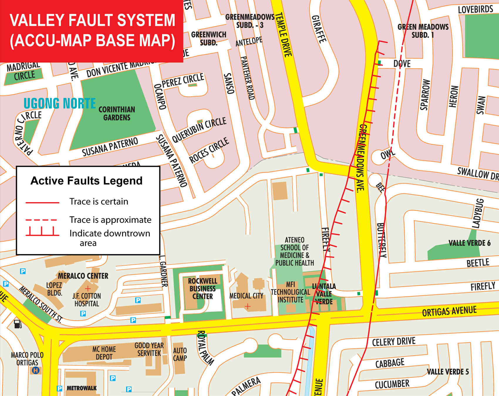
Sample Digitized Fault System super-imposed on Accu-map digital base maps (2014) and compilation of 66 pages of the Greater Metro Manila area where the Valley Faultline System (VFS) passes though.
*Namria map for reference purpose only.
FEATURES
- Precise projection of VFS as provided by NAMRIA
- Updated Points of Interest through 2016 survey
- Legend containing bodies of water, roads, contours and buildings
- Can be rendered in Digital or Print format