24 years of Cartography Excellence

Customized Tourism and Vicinity Maps

  • METRO MANILA Wall Map Horizontal
    MMMap-horizontal
    • Scale 1:20,500
    • Dimensions:  94″ x 44″ (7.82′ x 3.67′)
    • Map projection: UTM Zone 51 North Luzon 1911 Datum
    • Color coded by city/municipality
    • Printed using large-format ink jet color graphics printer
    • Available media for printing:
      • (1) Laminated Photo paper
      • (2) Laminated sticker paper on Sintra board
    • Price:  (1) Php12,500.00    (2) Php16,300.00 
    • Available also with wood or plastic frame (inquire for pricing)
  • METRO MANILA Wall Map Vertical
    MMMap-vertical
    • Scale 1:20,500
    • Dimensions:  44″ x  94″ (3.67′ x 7.82′)
    • Map projection: UTM Zone 51 North Luzon 1911 Datum
    • Color coded by city/municipality
    • Printed using large-format ink jet color graphics printer
    • Available media for printing:
      • (1) Laminated Photo paper
      • (2) Laminated sticker paper on Sintra board
    • Price:  (1) Php12,500.00    (2) Php16,300.00 
    • Available also with wood or plastic frame (inquire for pricing)
  • Philippine Map – Political Made to order
    ph-map
    • Philippine Map – Political
    • Dimensions: 44″ X 69 ” (3.67 ft X 5.75 ft)
    • Scale 1:1,100,000
    • Map projection: Universal Transverse Mercator Zone 51 North, Luzon 1911 Datum
    • Longitude/latitude grid reference
    • Includes major, secondary and tertiary roads
    • Index to cities and municipalities
    • Provincial and regional boundaries
    • Color coded by region
    • Printed using large-format ink jet color graphics printer
    • Available media for printing:
      • (1) Laminated Photo paper
      • (2) Laminated sticker paper on Sintra board
    • Price:  (1) Php12,500.00    (2) Php15,600.00 
    • Available also with wood or plastic frame (inquire for pricing)
  • Philippine Map Full Customization
    ph-map
    • Scale 1:2,000,000
    • Map projection: Universal Transverse Mercator Clarke Spheroid 1866 Luzon Datum
    • Longitude/latitude grid reference
    • Includes major, secondary and tertiary roads
    • Index to cities and municipalities
    • Provincial and regional boundaries
    • Color coded by region
    • Full customization including:
      • Colors
      • Details
      • Airplane and Shipping routes
      • Company Logo
    • Fully updated
  • World Map – Physical
    world-map-physical
    • Scale 1:16,500,000
    • Dimensions:  86″ x 44″ (7.17′ x 3.67′)
    • Map projection: Plate Carr ée WGS84 Datum
    • Longitude/latitude grid reference
    • Printed using large-format ink jet color graphics printer
    • Available media for printing:
      • (1) Laminated Photo paper
      • (2) Laminated sticker paper on Sintra board
    • Price:  (1) Php12,500.00    (2) Php16,100.00 
    • Available also with wood or plastic frame (inquire for pricing)
  • MAP of the WORLD – Political
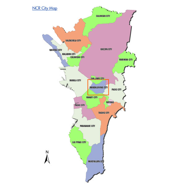
    world-map-political
    • Scale 1:30,500,000
    • Dimensions:  53.73″ X 28″ (4.48′ X 2.33′)
    • Map projection: Plate Carrée WGS84 Datum
    • Longitude/latitude grid reference
    • Color coded by country
    • National, state and provincial capitals and other major cities
    • International, state, provincial and regional boundaries
    • Available media for printing:
      • (1) Laminated Photo paper
      • (2) Laminated sticker paper on Sintra board
    • Price:  (1) Php5,00.00    (2) Php6,450.00 
    • Available also with wood or plastic frame (inquire for pricing)
  • NCR City Maps
    NCR-city-maps
    • Sizes may vary depending on request.
    • Contact us for additional details for purchasing.
  • Postal Code Map
    PostalCode
    • Sizes may vary depending on request.
    • Contact us for additional details for purchasing.
  • Barangay MapMade to Order
    BarangayMap
    • Contains borders of each barangay
    • Can be ordered per city or the whole NCR
    • Postal code map also available
    • Customizable
    • Available in printed format or digital file copy
  • Delivery Map (Radius) Made to order
    Abreeza
    • Contains specific radius of delivery per store (sample depicts 1.5km delivery radius)
    • Contains complete list of streets and barangay that store/branch services
    • Advisable for provincial locations
    • Customization available
    • Tailor-made for clients’ specific needs
  • Delivery Map (Boundary) : Made to Order
    marikina new
    • Delivery Map
    • Defined boundaries and fencing per store/branch
    • Delivery time limitations, including:
      • Drive time : (km/h)
      • Day time traffic
      • Road blocks and also Traffic restrictions
    • Corrected overlap due to close proximity of stores/branch
    • Customization available
    • Tailor-made for specific businesses
    • Especially relevant for Delivery services
    • Easy to read texts and symbols
    • Landmarks and buildings maybe included

    All our RTA maps are created tailor-made to our clients’ needs. We take into consideration all the specifications so that we can make sure that our maps target specific problem points. Speed of vehicles are computed against Day-time Traffic, road and traffic restrictions to come up with a realistic delivery time that would set our clients targets and expectations. Adjustments are also made to make our RTA maps’ scope bigger depending on the store hours. Example: a computed distance for day time traffic will be bigger that a computed distance on nighttime traffic, depending if the store closes late or is open 24 hours

  •    VIEW MAP SIZES